Valley Park History
What we know
Location & size
Valley Park is located just south of Welbury Way, Southfield Lea, Cramlington in Northumberland. It has the grid reference: NZ 26512 75077, What 3 Words: pencil.crate.went, and the area is 18.86 hectares or 46.6 acres in size and is designated open green space by Northumberland County Council.
The current site
This a large area of woodland and public open space at the southern end of Cramlington. It is bordered on the north and west by residential areas and to the south and east by the A19 and A189 roads.
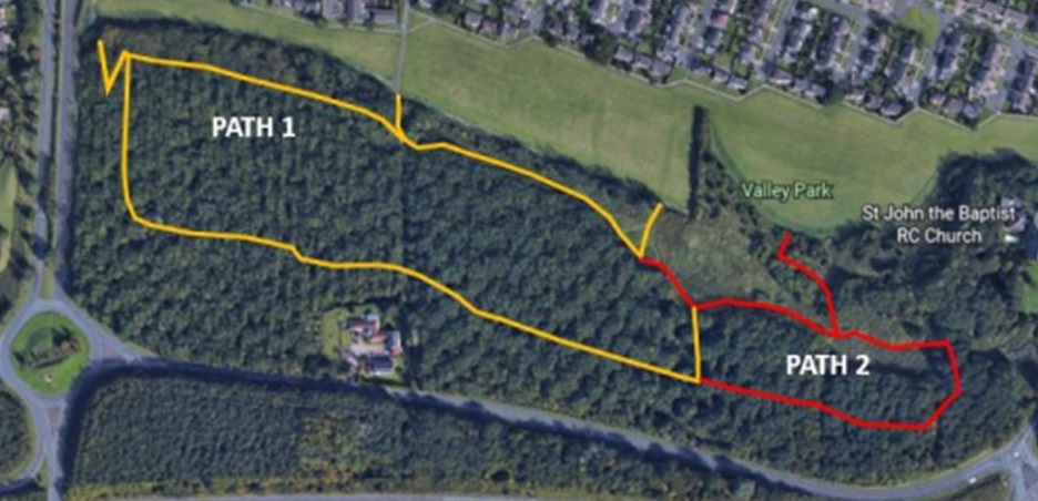
The site provides a diverse mix of habitats including mature woodland, ponds and reed beds, rough grassland, a community orchard and a wildflower meadow.
The current woodland has a network of footpaths of which the main paths throughout the site are crushed stone footpaths. These paths were all resurfaced during 2023 as part of Northumberland County Councils Commemoration program to celebrate the life of Queen Elizabeth II. Other paths are generally dirt tracks used to link various sections of the site.
Two wooden bridges cross the stream which separates the grass meadows from the woodland. A stone bridge also crosses the stream at the main entrance to the woodland.
Two ponds within the woodland which were both 99% silted up with reeds and debris were dredged in 2023 to allow between 30% and 60% open water whilst retaining some reed beds and overgrown areas as these will add to the biodiversity of the area. A new boardwalk and pond viewing area will be installed in spring 2024.
A community orchard of 50 large fruit trees was also created with 10 gooseberry bushes planted nearby.
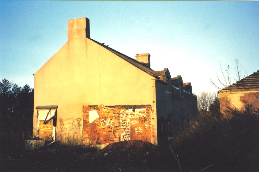
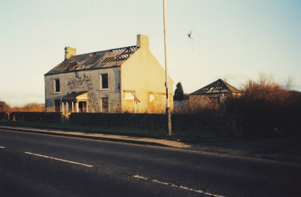
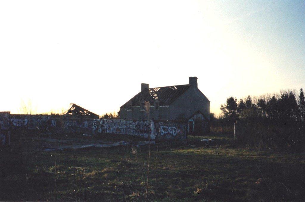
The old farm
During the late 1980’s and early 1990’s the once thriving farm became abandoned and dilapidated before it was redeveloped into modern private dwellings that are there now.
Here are some of the images of the old building.
Farm History
New Moor, Moor House or Moorhouse Farm now Manor Farm
Dated from the 18th Century New Moor Farm or Manor Farm as it is now named (formerly Moorhouse Farm). It first appeared in Armstrong’s Map of Northumberland dated 1769.
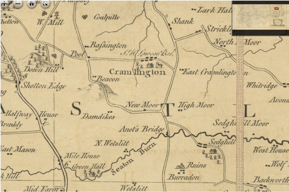
It was situated on the southern edge of Cramlington on uncultivated wasteland before it was farmed. The farmhouse stood next to what was then a subsidiary road connecting Newcastle and Bedlington and running Dam Dykes and Arcot Hall. This road is now called the A1171.
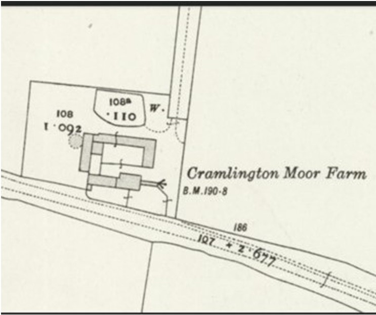
The farm was tenanted by the Hood family in the middle of the 19th Century and was described as consisting of around 218 acres. Early ordnance surveys maps show a traditional South Northumberland farm layout with the main farmhouse facing south and the farm buildings arranged to its rear forming a farm yard. The east range also contained a ging-gang, a circular mechanical horse-driven engine house which was also very common in this part of Northumberland.
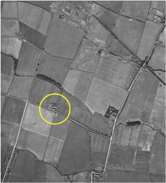
The planned development of Cramlington New Town in the 1960’s and particularly the carving out of the A189 which later was renamed the A19, reduced the farm of a lot of its land. What has been left now has new housing estates or is densely planted woodland. The farm is now a private residence which incorporates the old ging-gang as an aesthetic on a private residence along with the old Farm House and Barn in around 2002. At around the same time a large portion of the woodland was planted which is now seen as Valley Park and has recently had a new orchard and further trees planted.
